
Multiple severe thunderstorm alerts have been issued across several counties in South Carolina as weather conditions continue to deteriorate. Meteorologists are warning residents to stay alert as strong storm systems move through the region, bringing heavy rainfall, lightning, and potentially damaging winds. These alerts indicate a heightened risk of hazardous weather that could impact daily life and outdoor activities.
Authorities are closely monitoring the situation and advising residents to follow official updates. Emergency services are on standby to respond to any incidents caused by the storms. People living in affected areas are encouraged to secure loose objects, avoid unnecessary travel, and prepare for possible power outages as the severe weather intensifies.
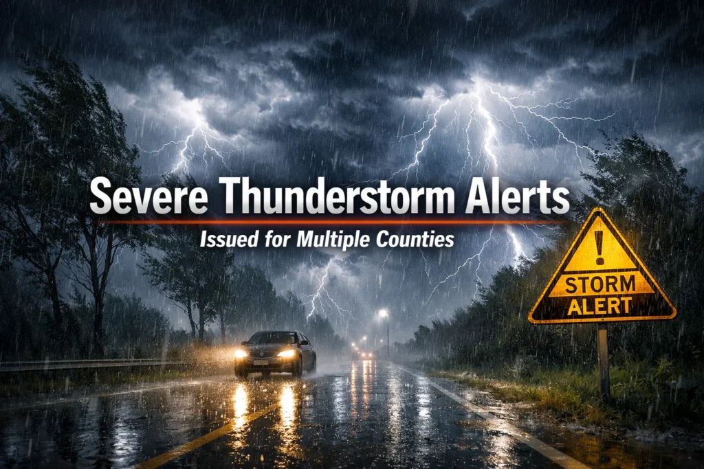
Severe Thunderstorm Alerts in South Carolina
Severe thunderstorm alerts across South Carolina highlight the increasing intensity of the current weather system. These alerts are issued when storms are capable of producing strong winds, hail, and heavy rainfall that may lead to flooding. Residents are urged to take precautions as conditions can change rapidly within a short period of time.
Local weather departments continue to provide real-time updates to keep communities informed. Staying indoors, keeping emergency supplies ready, and avoiding open areas during lightning activity are key safety measures. The alerts serve as an important warning system to help minimize risks and protect lives and property.
Strong Storms Hit the Region
Strong storms have swept across the region, bringing powerful wind gusts and intense rainfall that continue to impact daily life. These storms have already caused disruptions in several areas, including fallen trees, road blockages, and temporary power outages affecting many households. The fast-moving system is expected to continue impacting multiple locations throughout the day, with authorities closely monitoring the situation and issuing timely updates to ensure public safety.
Weather experts suggest that the combination of high moisture levels and unstable atmospheric conditions is fueling these storms. As a result, some areas may experience sudden bursts of heavy rain, lightning, and strong winds that can quickly escalate. This can reduce visibility, flood roadways, and create dangerous driving conditions for commuters and travelers, especially during peak hours when traffic is heavier.
Residents are strongly advised to remain cautious and stay updated through official weather channels and emergency alerts. Taking early precautions, such as staying indoors, securing outdoor items, and avoiding unnecessary travel, can significantly reduce potential damage and risks. The situation remains highly dynamic, and further developments are expected as the storm system continues to evolve across the region.
Latest Weather Updates
The latest weather updates indicate that severe thunderstorms are continuing to develop and move across South Carolina, affecting multiple counties. Meteorologists are closely tracking numerous storm cells producing heavy rainfall, frequent lightning, and strong wind gusts. These updates are essential for residents to stay informed about rapidly changing conditions and to take necessary precautions to protect themselves and their property. Staying connected to official weather channels ensures that people receive accurate, timely information.
Current reports suggest that some areas may experience localized flooding due to intense rainfall, particularly in low-lying regions and areas with poor drainage. Residents in these zones are urged to remain alert and monitor weather alerts continuously. Emergency services are actively issuing warnings and advisories to safeguard communities. Officials recommend checking updates regularly, following instructions, and avoiding unnecessary travel. With the weather situation remaining highly active, continuous monitoring and preparedness are crucial to minimize risks and stay safe.
Affected Counties List
Several counties in South Carolina are currently under severe thunderstorm alerts as the storm system continues to move across the region. These areas are experiencing strong winds, heavy rainfall, and occasional lightning, creating hazardous conditions for residents. People living in these counties are advised to stay informed through official weather updates and take necessary precautions to protect themselves and their property. Schools, businesses, and public facilities may also adjust schedules or close temporarily to ensure public safety.
Local authorities have highlighted specific high-risk zones where the impact of the storms could be more severe. These areas may experience flooding, fallen trees, and power outages. Emergency services are on standby to respond quickly to any incidents, ensuring help is available when needed. Residents are also being encouraged to check on neighbors, especially the elderly or those with mobility challenges, to ensure community safety during the storm.
Residents are urged to remain indoors and avoid unnecessary travel while continuously monitoring official alerts and advisories. Preparing emergency kits with essentials such as water, non-perishable food, flashlights, and batteries can be crucial during prolonged severe weather. By securing outdoor items and staying vigilant, communities can minimize damage and stay safe during this intense storm event.
Storm Timing Details
| Time Period | Expected Conditions | Risk Level |
| Morning | Light rain, increasing clouds | Low |
| Midday | Thunderstorms begin developing | Moderate |
| Afternoon | Strong storms, heavy rain, and winds | High |
| Evening | Peak storm activity, lightning | Very High |
| Night | Storms gradually weaken | Moderate |
Wind and Rain Threat
Severe thunderstorms moving across South Carolina are bringing a significant wind and rain threat to multiple counties. Strong wind gusts can exceed dangerous levels, capable of damaging roofs, uprooting trees, and causing widespread power outages. Heavy rainfall within a short period may overwhelm drainage systems, increasing the risk of flash flooding in urban and low-lying areas.
The combination of heavy rain and gusty winds creates hazardous conditions for both residents and drivers. Streets may quickly become flooded, while falling debris can pose serious safety risks. Officials are urging people to remain indoors during peak storm hours and avoid unnecessary movement. Staying updated with weather alerts and securing outdoor items can help minimize potential damage.
Tornado Risk Update
Current Tornado Risk Level
Meteorologists are closely monitoring the storm system as conditions remain favorable for isolated tornado development. While not every thunderstorm produces a tornado, certain cells may intensify rapidly. Residents in affected areas should remain alert as tornadoes can form with little warning during severe weather outbreaks.
Weather experts emphasize that atmospheric instability and wind shear are contributing factors to this elevated risk. These elements can cause rotating storm systems capable of producing tornadoes. Even a brief touchdown can result in localized damage, making awareness and preparedness extremely important.
Communities are advised to keep emergency alerts enabled and identify safe shelter locations in advance. Acting quickly when warnings are issued can significantly reduce the risk of injury. Staying informed is key during such unpredictable weather situations.
Areas Under Tornado Watch
Several regions within South Carolina have been placed under a tornado watch as storm conditions continue to evolve across the state. A tornado watch means that weather conditions are favorable for tornado formation, even though no tornado has been confirmed yet. Residents in these areas should remain alert, monitor official weather updates closely, and be prepared to take action if conditions worsen. Staying informed during a watch can help reduce risks and ensure timely safety measures.
A tornado watch usually covers a large geographic area and can remain in effect for several hours. During this period, people should review their emergency and safety plans, identify safe shelter locations, and prepare essential items such as water, flashlights, and first-aid supplies. Authorities also recommend avoiding outdoor activities and staying near a reliable source of weather information. Quick awareness and readiness during a tornado watch can make a critical difference in ensuring personal and community safety.
What to Do During a Tornado Warning
When a tornado warning is issued, it means that a tornado has been sighted or detected on radar, and immediate action is necessary to protect yourself, your family, and your pets. Take shelter in a basement, storm cellar, or a windowless interior room on the lowest floor of a solid building. Avoid windows, glass doors, and exterior walls to minimize the risk of injury from flying debris. It is also important to stay away from large furniture or objects that could tip over during high winds.
Cover yourself with heavy materials such as mattresses, blankets, pillows, or even thick clothing to shield against debris. Mobile homes, vehicles, and temporary structures are extremely unsafe during tornadoes, so it is essential to move to a solid building as quickly as possible. If no basement is available, take shelter in a small interior closet or bathroom and crouch low to the ground. Acting quickly and decisively can save lives during these extremely dangerous and unpredictable weather events.
Remain in your safe location until authorities officially confirm that the tornado threat has completely passed. Continuously monitor emergency broadcasts, weather apps, and local alerts, and follow guidance from emergency personnel. Keep your phone nearby for updates, and check on family members and neighbors if it is safe to do so. Staying informed, calm, and prepared ensures that you and your loved ones remain safe throughout the duration of the storm.
Safety Tips for Residents
Residents in areas affected by severe thunderstorms should take immediate precautions to protect themselves and their families. Staying indoors is crucial, particularly during strong winds, heavy rain, and lightning activity. Unplugging electrical appliances can help prevent damage from power surges, while securing windows and doors adds an extra layer of safety against flying debris. Following these basic measures can significantly reduce potential hazards during the storm.
Preparing an emergency kit is highly recommended to ensure essential supplies are available if needed. Include items such as drinking water, non-perishable food, flashlights, batteries, and necessary medications. Keeping mobile phones fully charged and having a backup power source allows communication to continue during power outages. Families should also discuss and review emergency plans so everyone knows what to do if conditions worsen quickly.
Residents should avoid going outside unless necessary and never attempt to drive through flooded roads, which can be extremely dangerous. Regularly monitoring weather updates and official alerts helps people respond promptly to changing conditions. By staying prepared, cautious, and informed, residents can significantly reduce risks and protect themselves during severe weather events.
Watch vs Warning Explained
Understanding the difference between a watch and a warning is crucial during severe weather events to ensure proper safety measures. A thunderstorm or tornado watch means that conditions are favorable for severe weather to develop in the area. It serves as an early alert, giving residents time to prepare, review safety plans, and stay aware of potential risks before the storm strikes. Watches typically cover larger areas and last longer to give people enough time to get ready.
In contrast, a warning indicates that severe weather is already occurring or is imminent in a specific location. This is a more serious alert that demands immediate action to protect life and property. Residents should seek shelter, avoid travel, and follow emergency instructions from local authorities. Warnings are usually shorter in duration but signal a higher level of danger compared to a watch.
Knowing the difference between a watch and a warning helps individuals respond effectively to changing conditions. While a watch encourages preparedness, a warning requires quick protective action. Staying informed through official weather alerts and notifications can make a critical difference in minimizing risks and ensuring safety during severe weather emergencies.
How to Prepare for Storms
Preparing in advance for severe storms can significantly reduce risks to both safety and property. Begin by securing outdoor items such as furniture, tools, decorations, and other loose objects that could be blown away by strong winds. Ensuring that windows, doors, and garage openings are properly closed and reinforced can help protect your home from potential storm damage. Taking these precautions early can prevent costly repairs and reduce hazards during the storm.
Creating a well-stocked emergency kit is another essential step. Include drinking water, non-perishable food, medications, flashlights, batteries, and important documents. Having a backup power source or portable charger ensures you can stay connected during power outages. Additionally, keeping a first-aid kit and basic tools on hand can be invaluable in case of emergencies.
Developing a family emergency plan ensures everyone knows what to do during severe weather. Identify safe areas in your home, such as basements or interior rooms, and establish clear communication methods in case family members are separated. Being proactive and prepared reduces panic, improves response times, and ensures the safety of everyone in your household during storms.
Travel and Daily Impact
Severe thunderstorms can cause major disruptions to travel and daily life across South Carolina. Heavy rainfall, gusty winds, and reduced visibility make driving extremely hazardous, while fallen trees and debris can block roads unexpectedly. Public transportation services, including buses and trains, may face delays or cancellations, and flights are often delayed or rescheduled due to unsafe flying conditions. Residents are urged to monitor traffic updates and follow official advisories before traveling.
Commuters are strongly advised to check weather updates regularly and consider postponing travel if possible. Flooded streets, slippery surfaces, and downed power lines can significantly increase accident risk. Planning alternative routes, leaving early, and exercising caution while driving can help reduce potential hazards. Staying informed allows individuals to make safer travel decisions during intense weather conditions.
Daily routines such as work, school, and outdoor activities are also likely to be impacted. Businesses, schools, and public institutions may adjust schedules or close temporarily to prioritize safety. Residents should remain flexible, stay indoors when necessary, and follow official guidance. By taking precautions and preparing for interruptions, communities can minimize risks and stay safe throughout the severe weather event.
Emergency Weather Alerts
Importance of Weather Alerts
Emergency weather alerts play a vital role in keeping communities informed and protected during severe storms. These alerts deliver real-time updates about rapidly changing weather conditions, allowing residents to take immediate and effective action. With accurate and timely information, people can avoid dangerous situations, reduce property damage, and stay safe. By staying connected through mobile notifications, broadcasts, and official sources, individuals ensure they never miss critical warnings that could potentially save lives.
How Alerts Are Issued
Weather alerts are issued through advanced monitoring systems, including radar, satellites, and expert meteorological analysis. Specialists continuously observe storm patterns and atmospheric changes to detect potential threats early. Once a significant risk is identified, alerts are quickly sent to affected regions to ensure public awareness. These alerts vary in severity, such as watches and warnings, helping people understand the level of danger and respond appropriately to protect themselves.
Responding to Emergency Alerts
Responding quickly to emergency alerts is essential for ensuring personal safety during severe weather events. As soon as an alert is received, individuals should carefully review the information and follow all recommended actions without delay. This may include seeking shelter, avoiding travel, or preparing emergency supplies. Acting promptly and staying calm can greatly reduce risks, while following guidance from authorities ensures better protection for both individuals and their families.
Live Storm Updates
Live storm updates are essential for tracking severe weather conditions across South Carolina, providing real-time insights into storm movement, intensity, and potential threats. These updates help residents stay informed and make quick decisions to protect themselves and their property. With rapidly changing weather patterns, relying on accurate and timely information becomes critical for safety.
Weather conditions can shift unexpectedly, making continuous monitoring extremely important during severe storms. Updates often include warnings, advisories, and safety instructions issued by authorities. Staying connected to reliable sources allows individuals to respond quickly to new risks, reduce potential damage, and remain better prepared throughout the storm.
Conclusion
Severe thunderstorms and tornado threats across South Carolina highlight the importance of staying informed, prepared, and cautious. By closely monitoring weather updates, following emergency alerts, and taking proactive safety measures, residents can protect themselves, their families, and their property from potential damage. Securing outdoor items, preparing emergency kits, and understanding the difference between watches and warnings are essential steps during severe weather events. Remaining vigilant, following official guidance, and acting promptly can significantly reduce risks and ensure safety throughout these dangerous storm conditions.
FAQs
What does a severe thunderstorm alert mean?
A severe thunderstorm alert indicates that conditions are favorable for thunderstorms capable of producing heavy rain, strong winds, lightning, and hail. Residents should stay alert and take precautions to protect themselves and their property.
Which counties in South Carolina are affected by the alerts?
Multiple counties across the state are under alert, especially those experiencing high winds and heavy rainfall. Residents should monitor official weather updates to know which areas are most at risk.
What is the difference between a thunderstorm watch and a warning?
A watch means conditions are favorable for severe weather, and people should prepare. A warning means severe weather is occurring or imminent and immediate action is required to stay safe.
What steps should I take to stay safe during a severe thunderstorm?
Stay indoors, unplug electrical appliances, avoid flooded roads, and follow official updates. Prepare an emergency kit with water, food, flashlights, and batteries to handle potential power outages or disruptions.
What should I do during a tornado warning?
Seek shelter in a basement or interior room on the lowest floor of a sturdy building, avoid windows, and cover yourself with heavy materials. Mobile homes and vehicles are unsafe during tornadoes, so proper shelter is essential.